Fly
The drone follows repeatable survey lines at a controlled height above the terrain.

How flying closer to the surface can improve detection of buried pipelines, utilities, and unexploded ordnance.
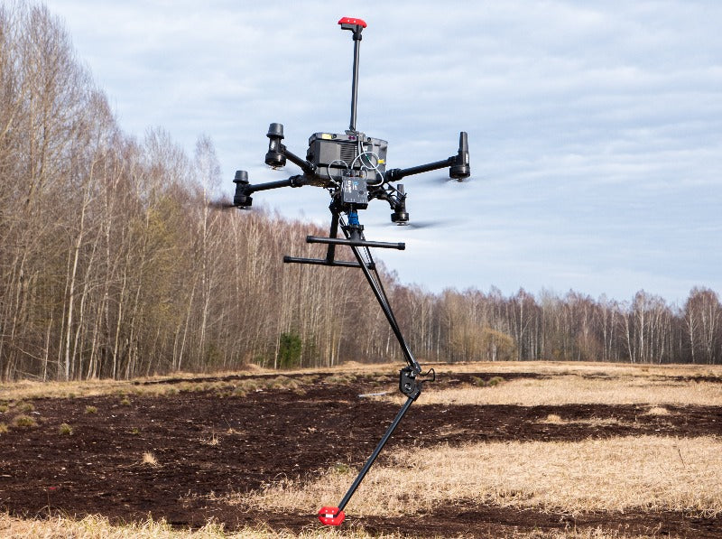
A drone carrying a magnetometer can reveal more about buried objects by flying close to the surface.
MagNIMBUS from SPH Engineering combines a sensitive magnetometer, precise flight paths, and positioning data to map subtle changes in the magnetic field.
Steel pipelines, utilities, artillery shells, and other ferrous objects disturb the Earth’s magnetic field. A magnetometer records these disturbances as local anomalies.
Distance has a strong effect. A compact object often behaves approximately like a magnetic dipole, so its field falls rapidly as the sensor moves away and may become difficult to distinguish at higher altitude.
As a rough guide, doubling the distance from a dipole-like target can reduce the measured field to about one-eighth, although results also depend on the object and its surroundings.
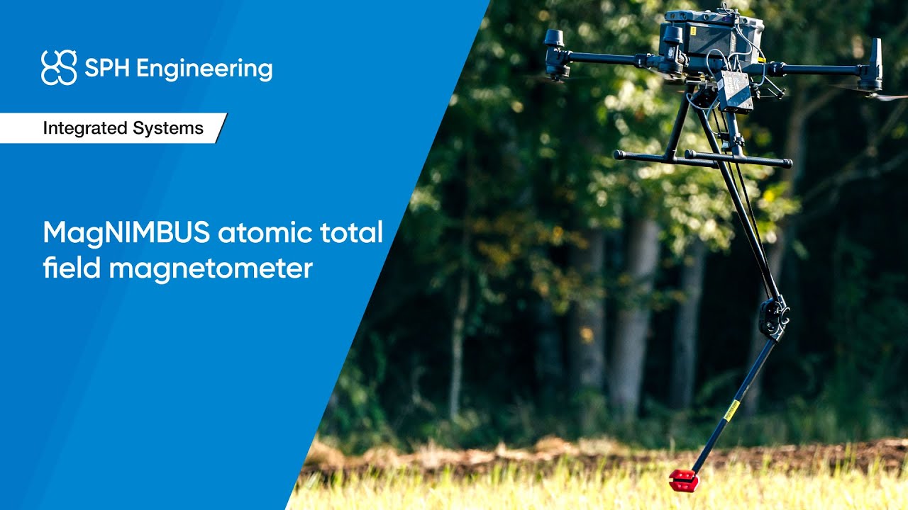
SPH Engineering’s overview shows the folding sensor mount, drone integration, and low-altitude operation.
Airborne magnetic surveys introduce practical constraints: the sensor must work near motors and electronics, maintain a consistent height over uneven terrain, and tolerate contact with grass or low obstacles.
MagNIMBUS addresses these constraints with a folding mount, RTK positioning, onboard logging, automated flight planning, and terrain following. It can operate within tens of centimeters of the surface while the crew remains outside the survey area.
MagNIMBUS uses the compact, low-power QuSpin QTFM atomic total-field magnetometer. It measures field magnitude rather than a single directional component, which is useful on a moving aircraft.
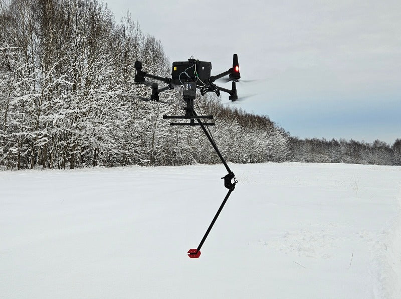
MagNIMBUS can use one sensor to measure the total field or two vertically separated sensors to form a gradiometer. The two sensors record simultaneously at different heights.
Subtracting the readings produces the vertical magnetic gradient, which tends to emphasize nearby anomalies and reduce broader background variation. Because the measurements are simultaneous, one flight can produce the gradient.
Using two synchronized sensor heights can make local field changes clearer in a single flight.
The magnetometer records field measurements rather than an image of an underground object. Positioning data ties each reading to a location, and processing produces a georeferenced anomaly map.
The drone follows repeatable survey lines at a controlled height above the terrain.
The system pairs each magnetic-field reading with precise positioning data.
Processing identifies anomalies and their coordinates for focused follow-up work.
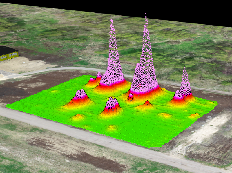
In a buried-utility test, a single-sensor MagNIMBUS system clearly delineated nearly every known target found by the ground-based and competing UAV systems. The shared exception was a thin steel pipe that no magnetometer had previously detected at the site.
The UAV survey was reported to be about 45% faster and used a pilot and observer rather than a three-person ground crew.
In a separate pipeline comparison, MagNIMBUS and a competing airborne system both detected the primary buried pipelines. MagNIMBUS produced a sharper vertical-gradient result from simultaneous measurements in one flight, though its rigid mount placed the sensor closer to electromagnetic noise from the aircraft.
In UXO testing, SPH Engineering reports that MagNIMBUS detected 57 targets at 0.2 meters and 20 at 1.0 meter over the same field. This illustrates the effect of sensor-to-target distance but is not a universal detection guarantee.
For suspected unexploded ordnance, the aircraft can enter the survey area while operators remain at a safer distance. The same approach can help cover farmland, shorelines, mudflats, and other terrain that is difficult to survey on foot.
The map does not identify every object with certainty or remove a potential hazard. It helps specialists narrow the search and decide where closer investigation is warranted.
MagNIMBUS shows how compact atomic sensors can support precision airborne magnetic surveys, particularly when a short sensor-to-target distance matters.
Performance figures describe the cited test conditions and should not be interpreted as guarantees for every site or target. MagNIMBUS images are courtesy of SPH Engineering.